Airfield
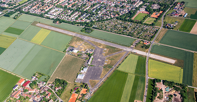
The former US Army airfield is situated in the Kirchheim district, to the south of the historic Kurpfalzachse cycle route. To the north it directly borders the city’s Pfaffengrund district.
Redevelopment area with few existing buildings
Existing buildings cover just 1.8 hectares of the site, a relatively small proportion of the total area of 15.6 hectares. In the main, these buildings form part of the airport itself, such as the tower and hangars. The runway is 1,070 meters in length and 30 meters wide. Diebsweg provides a link for private transportation. This road crosses the runway and connects Speyerer Strasse and Eppelheimer Strasse, thus linking the districts of Kirchheim and Pfaffengrund. Currently the site is not directly connected to the local public transportation network.
The US aircraft were moved to Mannheim and Wiesbaden in September 2002. Since then, the airfield has continued to serve as a take-off and landing site for helicopters and as a location for the US fire service. The property was transferred to the German Federal Real Estate Agency in late April 2014. There is as yet no concept for the further planning and participation process. A project candidate from the International Architecture Exhibition (IBA Heidelberg) proposed integrating the airfield into an agriculture park.


